
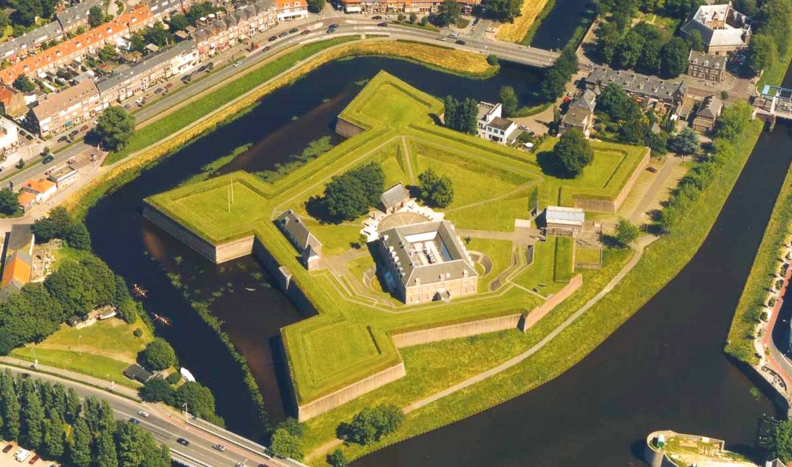
FORTE CULTURA Stop: the fortified town of ’s-Hertogenbosch (NL)
Image: denboschregion.nl
Den Bosch – European Fortified Town of the Year 2004
History and modernity in the capital of the province of North Brabant
The fortified town of ’s-Hertogenbosch (Den Bosch) was founded in 1185 by Duke Henry I of Brabant at a strategically favourable location between the rivers Dommel and Aa. Thanks to the surrounding marshes and an extensive system of fortifications, the town developed into one of the best-defended towns in the Netherlands and earned the nickname ‘Moerasdraak’ (Marsh Dragon).
During the Eighty Years’ War, Den Bosch remained under Spanish control for a long time and was considered impregnable. Thanks to the natural barrier provided by the water and the fortifications, enemies were unable to capture the town.
Nevertheless, Prince Frederik Hendrik succeeded in capturing the city in 1629. His army was able to reach the fortress by constructing dykes and draining the surrounding marshland. This battle, known as the „Siege of Den Bosch“, marked an important victory for the Republic. The victory marked a turning point in the Eighty Years’ War. Today, the fortifications, bastions and the surrounding countryside still serve as a reminder of this remarkable history.

Discover the fortified town ’Get to know ’s-Hertogenbosch (Den Bosch):

’s-Hertogenbosch was a fortified town. It was later incorporated into the Zuiderwaterlinie defence line.
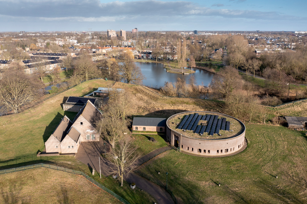
Fort Orthen
Fort Orthen was built in the 17th century as part of the defences surrounding Den Bosch. The fort protected the northern side of the town and made use of its strategic location on the floodplains of the Zuiderwaterlinie. The surrounding water and the fortifications made it possible to control and defend the area around Den Bosch.
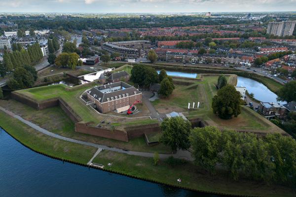
’s-Hertogenbosch Citadel
The ravelin at Bergen op Zoom is the only fully preserved defensive structure of the former Bergen op Zoom fortress. It was designed in 1703 by the fortress architect Menno van Coehoorn and formed part of the extensive defences surrounding the town.
Crossing a bridge and passing through a gate takes you into the ravelin, which still contains casemates, passageways and a powder magazine.
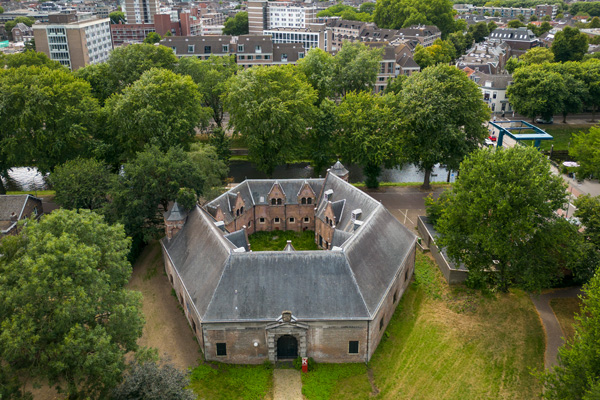
Kruithuis Museum
The Kruithuis Museum is housed in the last surviving gunpowder store from the Eighty Years’ War (17th century) in the Netherlands and tells the story of the fortified town and its military history. Here, visitors can learn how Den Bosch defended itself over the centuries as a key link in the Zuiderwaterlinie.
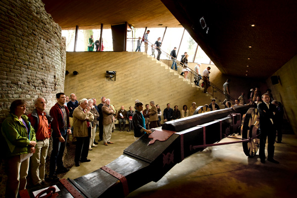
Bastionder
Beneath the Oranje Bastion lies the Bastionder, an underground visitor centre where you can literally walk through the old fortifications. Here you can learn all about the history of the „Bossche Fortress“ and the city’s role within the Zuiderwaterlinie.
Walking routes in the fortified town of ’s-Hertogenbosch
Den Bosch is a great place to explore on foot. Take a stroll through the historic city centre or choose a route through the „Bossche Broek“, where nature and the history of the fortifications come together. The Zuiderwaterlinie walking trail also runs along the outskirts of the city, taking you past forts, floodplains and historic defences.
A day in the fortified town of ’s-Hertogenbosch
A day in Den Bosch combines culture, history and nature.
Take a stroll through the charming alleyways, admire St John’s Cathedral, go for a boat trip on the Binnendieze or visit one of the museums. Round off the day on one of the cosy terraces in the historic city centre.
The History and Architecture of the Fortified City of ’s-Hertogenbosch
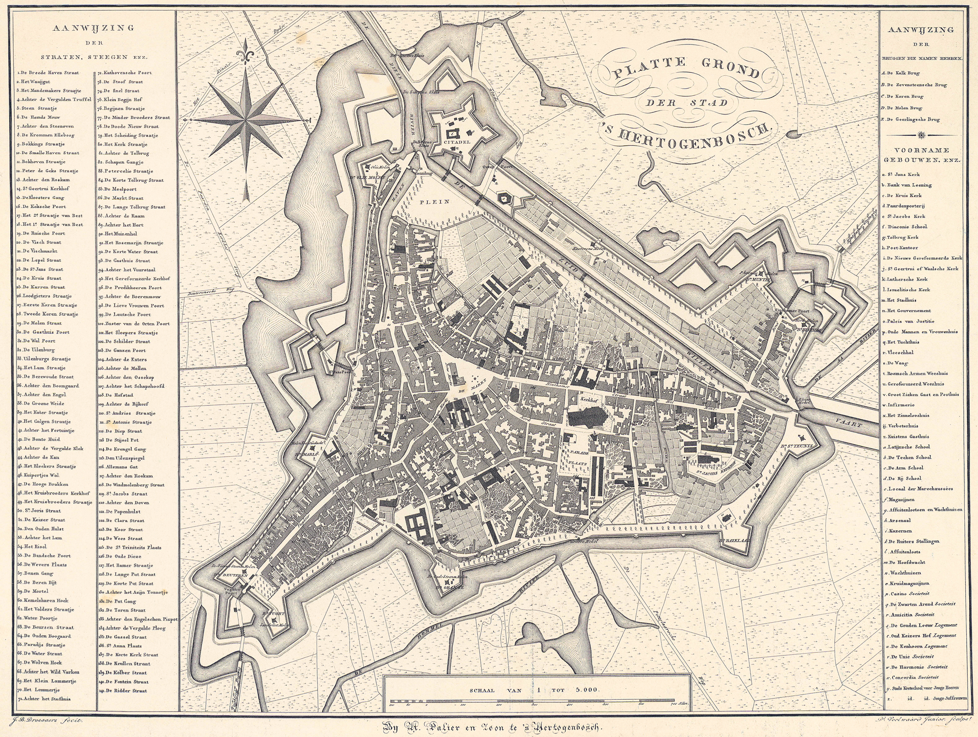
’s-Hertogenbosch, the legendary „Swamp Dragon“, owes its history to the close link between geomorphology and military technology. The town was founded in the 12th century (traditionally in 1185) by Duke Henry I of Brabant founded on a sand dune (Donk) in the midst of impassable moors. From the outset, he conceived it as a fortress to protect his interests against Holland and Gelre.
First town fortifications
The first city wall, built of brick and tuff, was erected around 1225, shortly after the town was granted its charter. It was built around the Donk in the centre of the town, which later became the market square. This crenellated enclosure wall had five city gates. Three of these gates are named after the main cities of the Duchy of Brabant: the Antwerpse Poort, the Leuvense Poort and the Brusselse Poort. They were built at the expense of the cities in question. In addition to these gates, there were two water gates: the Waterpoort on Herman Moerkerkplein and the Waterpoort on Sint-Geertruikerkhof.
The Aa, the Dieze and the Dommel flowed around the settlement, which stood on a sandy hill. The first wall was built along these watercourses, which became the town moat. The 7.50-metre-high enclosure wall was supported by arches and foundations. The first enclosure wall, completed in 1225, is one of the oldest masonry fortifications in the Netherlands. There are indications at several points in the townscape of where the gates stood and where the wall once ran. Only the southern Schleusentor remains today and is situated at the Groot Ziekengasthuis. The southern Waterpoorttor was built across a branch of the Dieze.
Second set of city defences
Under John III of Brabant From 1318 onwards, the site underwent a massive expansion to almost 100 hectares. During this phase, tall, slender walls were erected to repel siege ladders, as well as the complex system of canals in the Within ten with strategic water gates such as the Groote Hekel. The Antwerp Gate had to be demolished. The Leuvense Poort and the Brusselse Poort were given a new function. A total of eight gates were added: the Baseldonkpoort, Boompoort, Koepoort, Molensteegpoort, Orthense Poort, Pijnappelsche Poort, Sint-Jans Poort and Vughter Poort. Around 1540, the Hinthamer Poort was built, which later became a bastion. The River Aa also flowed through this gate.
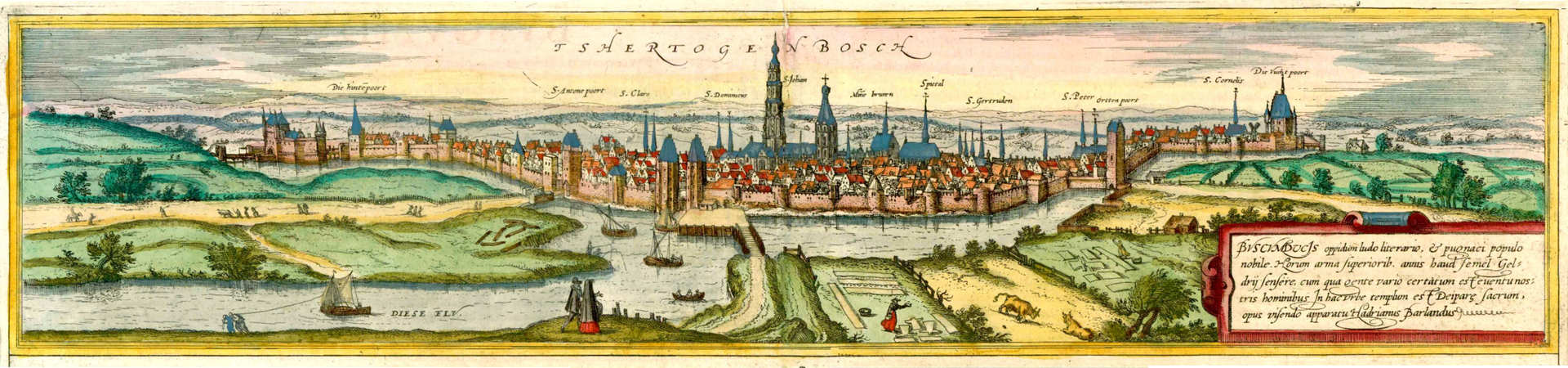
With the advent of heavy artillery in the 16th century, the walls were replaced by Bastions reinforced. Nevertheless, due to its location, the town was long considered impregnable, until Frederick Henry of Orange In 1629, he achieved a technological feat: he had the marshland drained using a 40-kilometre-long system of dykes and windmills so that the walls could be reached via moats.
Following the conquest, the States-General built the Citadel (presumably designed by Pieter Bilderbeeck). This pentagonal fortress, mockingly „Papenbril“ was intended not only to repel attacks, but also to keep the Catholic population under control by means of its inward-facing cannons.
Although the Fortifications Act of 1874 permitted the demolition of many structures, the city walls of Den Bosch remained largely intact, as they were considered vital Flood defences served. Since 1999, this heritage has been undergoing extensive restoration as part of a master plan.
To immerse yourself in the history, culture and art of ’s-Hertogenbosch, visit the Noordbrabant Museum and the Hieronymus Bosch Art Centre.


Modern extensions, alterations and restoration work
What makes Den Bosch unique is that the city walls were largely preserved when the fortifications were dismantled after 1874, as they were considered vital Flood defences served. Since 1999, these facilities have been part of the master plan „Reinforced Den Bosch“ thoroughly restored and given a modern twist:
- Sint Anthonie Bastion (restored in 2016): In order to restore the historic earthwork without damaging the monumental trees, engineers developed a modern „Ribbed structure“ made of Corten steel, which mimics the shape of the fortress whilst also serving as a footpath.
- Bastionder (Bastion Oranje): An underground information centre has been built within this bastion, combining modern architecture with the historic remains of the walls and the heavy artillery piece known as „Boze Griet“.
- Integration of infrastructure: In the redesign of the Smoke and Fire Area The construction of an underground car park was directly linked to the restoration of the city walls and the re-establishment of the medieval ground level.
- Modernised city gates: As the old gates had to make way for traffic, modern buildings have been erected in some places; these draw on the function and aesthetics of historic gate structures and serve as offices or flats.
- Restoration of the Binnendieze: After decades of neglect and use as a sewer, the canal system has been restored and now features new tunnels, such as the navigable passage at the Kruisbroedershekel, has once again been fully developed for tourism.


The Bosch Time Machine
The „The Bosch Time Machine“ brings 800 years of local history to life. Our aim is to link and visualise big data from the past in order to identify patterns and connections between historical figures, places and events. It’s like a historical Google Earth, allowing you to navigate through the city, through time and space. Or like a medieval Facebook, as it reveals personal networks from the past. The Den Bosch Time Machine makes the history of ’s-Hertogenbosch accessible to the public.
The area around Den Bosch is home to nature reserves that are closely linked to the history of this fortified town. The „Bossche Broek“ offers sweeping views of the ramparts, whilst the Dieze estuary and the „Pettelaarse Schans“ demonstrate how water was once used to defend the town. As you follow the walking and cycling paths, you’ll pass marshes, old floodplains and historic defences.
Discover the countryside around Den Bosch


events
There’s plenty going on in Den Bosch. Take a look inside the Calendar of events, to find out about what’s on offer locally.
Contact us

The community shop and the information centre at Moriaan
Markt 77, 5211 JX ’s-Hertogenbosch
Tel.: +31 (0)164 277 482
Partner

The Zuiderwaterlinie is regarded as the oldest, longest and most frequently used water defence line in the Netherlands: a unique chain of historic fortified towns, fortresses, redoubts, dykes and floodplains that defended the country for centuries with the help of water. Zuiderwaterlinie Alliance is an important partner of FORTE CULTURA, and selected fortresses of the Zuiderwaterlinie form part of our European Cultural Route.
Wenn du dies siehst, nachdem deine Seite vollständig geladen wurde, fehlen leafletJS-Dateien.
 Deutsch
  English (UK)
  Français
  Italiano
  Polski
  Español
  Čeština
Schreibe einen Kommentar