
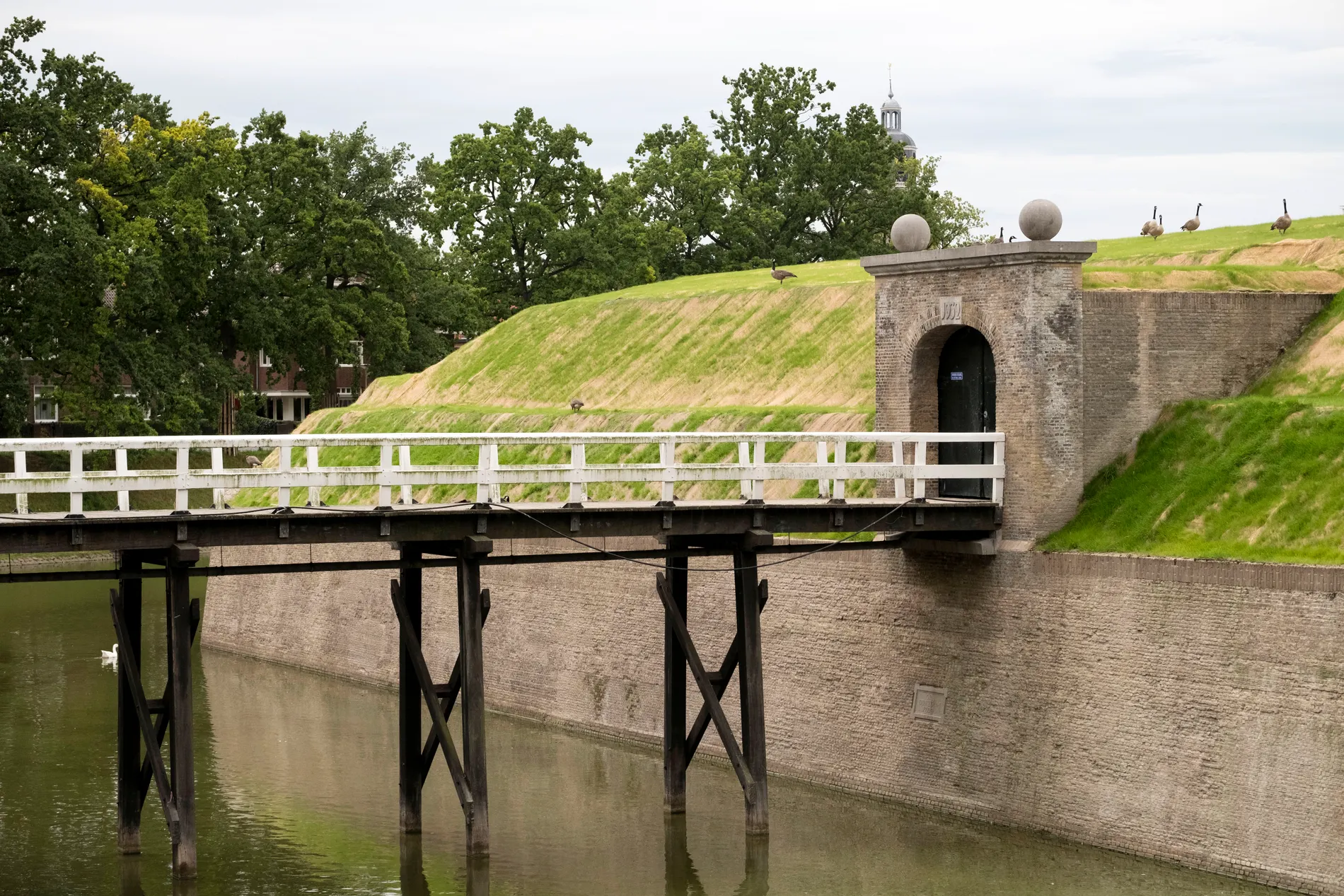
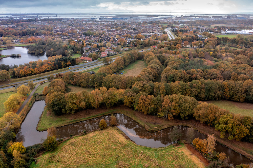
FORTE CULTURA Stop: the fortified town of Bergen op Zoom (NL)
Image: Martin Daleman
Bergen op Zoom – The impregnable fortified town
The fortified town of Bergen op Zoom was founded in the Middle Ages at a strategically favourable location between Zeeland and Brabant. Thanks to its position on important trade routes, the town developed into a prosperous trading centre and later became one of the Republic’s strongest fortresses.
During the Eighty Years’ War, the town was further fortified with bastions, moats and surrounding defences. In 1628, the West Brabant Water Line was established, utilising flooded areas and fortresses to hold back enemies. As a result, Bergen op Zoom became an important part of the Zuiderwater Line.
Would you like to find out more about this fascinating story? At the Markiezenhof, you can learn all about Bergen op Zoom, the fortified town and the Zuiderwaterlinie.

Discover the fortified town Get to know Bergen op Zoom:

Bergen op Zoom was a fortified town. It was later incorporated into the Zuiderwaterlinie defence line.
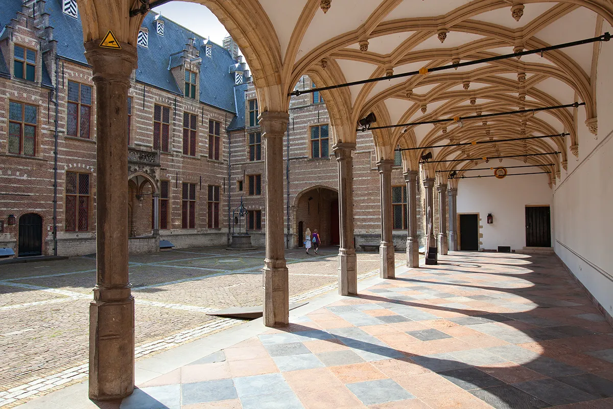
Markiezenhof
The Markiezenhof is the oldest town palace in the Netherlands and served as the residence of the lords and margraves of Bergen op Zoom from 1485 to 1727. Over the centuries, the building has served various purposes, including as a military hospital and barracks. Today, the Markiezenhof is a museum where visitors can learn all about the history of Bergen op Zoom, the fortified town and the Zuiderwaterlinie. It also regularly hosts exhibitions, concerts and other cultural events.
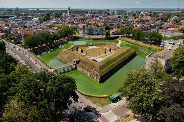
Ravelin op den Zoom
The ravelin at Bergen op Zoom is the only fully preserved defensive structure of the former Bergen op Zoom fortress. It was designed in 1703 by the fortress architect Menno van Coehoorn and formed part of the extensive defences surrounding the town.
Crossing a bridge and passing through a gate takes you into the ravelin, which still contains casemates, passageways and a powder magazine.
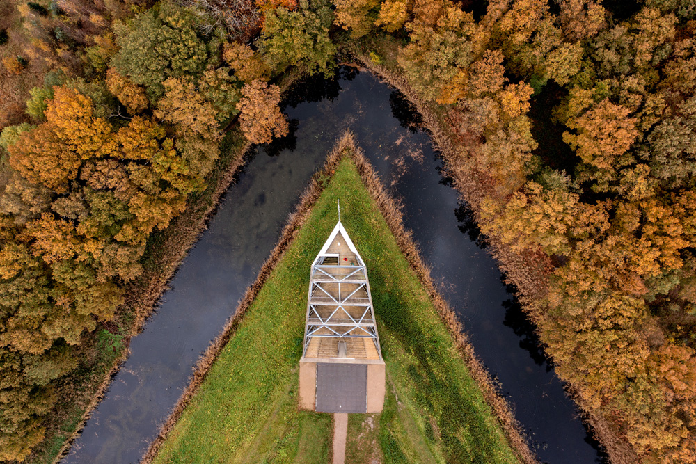
Fort de Roovere
Fort de Roovere was built in 1628 as part of the West Brabant Water Line to protect Bergen op Zoom from Spanish attacks. The fort was situated on a high sand ridge and, together with other forts and floodplains, formed an important line of defence.
Today, Fort de Roovere is a special place where nature and history come together. Visitors can stroll along the earthworks and walk across the water via the Mozes Bridge.
Fort Pinssen
Fort Pinssen was built in 1628 as part of the West Brabant Water Line and formed an important link between Fort de Roovere and Fort Moermont. The fort protected the surrounding floodplains and was part of the chain of forts, trenches and water defences surrounding Bergen op Zoom.
Walking routes in the fortified town of Bergen op Zoom
Bergen op Zoom is well suited to exploring on walking trails through the historic city centre and the surrounding countryside. A walk along the West Brabant Water Line takes you past forts, old ramparts and floodplains, and shows how water was used for defence in the past.
Cycling in and around the fortified town of Bergen op Zoom
The ANWB West Brabant Water Line Cycle Route takes you past various defensive structures, including Fort de Roovere, Fort Pinssen and the Ravelijn op den Zoom. Along the way, you can see how the forts, the water and the landscape together formed the former water line.
The History and Architecture of the Fortified Town of Bergen op Zoom
Since the Middle Ages, Bergen op Zoom has developed at a strategically important location between Brabant, Zeeland and the waterways leading to the Scheldt. Around 1330, work began on constructing city ramparts; towards the end of the 15th century, the fortifications of the town proper were linked to those of the harbour district. With the advent of powerful artillery, the medieval wall gradually evolved into an early modern fortress featuring low, massive earthworks, projecting bastions, moats and ravelins situated in front of the main defences.
This defence proved its worth on several occasions during the Eighty Years’ War. Spanish armies, led by the Duke of Parma in 1588 and by Ambrogio Spinola in 1622, failed to capture the town. The long siege of 1622 in particular reinforced Bergen op Zoom’s reputation as a fortress that was difficult to conquer: the defenders were able to receive supplies via the western waterways, whilst relief forces eventually forced the besiegers to retreat. These successes conferred great military and symbolic importance on the town for the Republic of the United Netherlands.
From 1628 onwards, Bergen op Zoom was incorporated into the West Brabant Water Line. To the north of the town, a chain of forts – including Moermont, Pinssen and De Roovere – was established, along with controllable floodplains. Locks, streams and canals made it possible to flood low-lying areas, whilst the forts blocked the dry approaches along the Brabantse Wal. The defences were thus based not solely on walls, but on the deliberate interplay of architecture, water management and the terrain.
Around 1700, the eminent military architect Menno van Coehoorn He completely redesigned the fortifications. He had the bastions reinforced, the ravelins and lunettes extended, and large sections fitted with dry moats and a system of underground counter-mines. The deeply staggered outer works were intended to force attackers to advance section by section under constant fire. The Ravelijn op den Zoom, constructed in 1703, is the most complete surviving part of this fortification and still conveys an impression of Coehoorn’s ingenious defence system.
However, the myth of its impregnability came to an end during the War of the Austrian Succession. Following a gruelling French siege, Bergen op Zoom fell in September 1747. Although the town returned to Dutch control as early as 1748, military developments gradually diminished the value of the elaborate fortress. In 1867, its status as a fortress was revoked; large sections of the ramparts and outer works were subsequently demolished to make way for urban expansion. Preserved elements such as the Ravelijn op den Zoom, the Waterschans and sections of the West Brabant Water Line nevertheless make Bergen op Zoom an outstanding site commemorating Dutch fortification and hydraulic engineering.
The West Brabant Water Line consists of fortresses, former floodplains and green landscapes where the workings of the old defences are still visible today. Particularly around Fort de Roovere and the Brabantse Wal, there are walking and cycling trails where you can experience the history of the Waterline at first hand amidst the countryside.
events
There’s plenty going on in Bergen op Zoom and the surrounding area. Take a look at the Calendar of events, to find out about what’s on offer locally.

Partner

The Zuiderwaterlinie is regarded as the oldest, longest and most frequently used water defence line in the Netherlands: a unique chain of historic fortified towns, fortresses, redoubts, dykes and floodplains that defended the country for centuries with the help of water. Zuiderwaterlinie Alliance is an important partner of FORTE CULTURA, and selected fortresses of the Zuiderwaterlinie form part of our European Cultural Route.
Wenn du dies siehst, nachdem deine Seite vollständig geladen wurde, fehlen leafletJS-Dateien.
 Deutsch
  English (UK)
  Français
  Italiano
  Polski
  Español
Schreibe einen Kommentar